 PRODIGE
irregular
Harvested
Provided by
Type of resources
Available actions
Topics
Keywords
Contact for the resource
Provided by
Years
Formats
Representation types
Update frequencies
status
Scale
Resolution
-
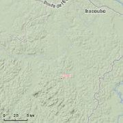
Guyadiv is a network of permanent forest plots installed in French Guiana. The site of Guyadiv in Counami is composed of 19 1200sq.m-plots. A complete inventory has been made on these plots, during 3 inventory sessions in 2000, 2001 and 2002. 1743 trees have been inventoried, with 92,2% to 100% of trees identified to species level. We only have the point coordinates and not the precise demarcation of the sample plots. In order to calculate the bounding box for these plots, we have expanded the point location 500 meters in each direction.
-
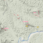
The site Quartzites is composed of two 3km-transects (20m wide). 2638 trees with dbh>=20cm have been recorded by Office national des forêts (ONF). No fauna inventories available. 276 under-storey plants have been recorded on 17 25m²-plots by Institut de recherche pour le développement (IRD). Soils have been described using 13 samples (1.20m depth max.) and two soil pits (1.50m depth). Laboratory analyses are available for one profile and for the two soil pits
-
Shom is the national referent for the level of the sea in situ on all areas under French jurisdiction. In this capacity, he assures under the acronym REFMAR different coordination functions in the collection and dissemination of public data related to water level observations, in order to promote their use in multiple applications within the framework of international recommendations.
-

Shom manages a network of permanent digital coastal tide-gauges on French coasts: the RONIM Sea Level Observation Network. Most tide-gauge observatories are partnered with one or more local partners.<br /><br /> Four main types of data are available for download:<br /> - “Raw high frequency" data: raw observations neither validated nor evaluated, obtained directly from the sensor. 1-minute measurement; integration time 15 seconds (on the minute); sampling period: 1 second.<br /><br /> - "Raw non-real time" data: raw observations neither validated nor evaluated, obtained directly from the sensor. 10-minute measurement; integration time 121 seconds (around every 10 minutes); sampling period: 1 second.<br /><br /> - "Validated non-real time" data: observations checked and validated by Shom from the "Raw non-real time" data. 10-minute measurement; integration time 121 seconds (around every 10 minutes); sampling period: 1 second.<br /><br /> - "Validated hourly" data: observations checked and validated by Shom, generated from "Validated non-real time" data. Hourly measurement obtained from the Vondrak filter with triangular weighting. The hourly height cannot be calculated in the event of an observation gap greater than 1.5 hours.
-

Le produit BD ORTHO® IGN V1 de 2001 est une collection de mosaïques d'orthophotographies numériques en couleurs, rectifiées dans la projection adaptée au territoire couvert. Le fichier vectoriel représente l'emprise des dalles 5 x 5 km du produit BD ORTHO® IGN 2001.
-
Le produit BD ORTHO® IGN 2011 est une collection de mosaïques d'orthophotographies numériques en couleurs (RVB) et Infra-Rouge (IR), rectifiées dans la projection adaptée au territoire couvert. Il s'agit de données "non validées".
-
Ce produit est une mosaique d'orthophotographies aériennes numériques couleurs des zones anthropisées des communes de Guyane de 2012 rectifiée dans la projection adaptée au territoire couvert.
-

Le produit BD ORTHO® 2006 est une collection de mosaïques d'orthophotographies numériques en couleurs ou en Infra Rouge couleurs, rectifiées dans la projection adaptée au territoire couvert.
-
Installation comprenant le dispositif fournissant de l'énergie mécanique ( roues à aube , turbine) et les équipements utilisant cette énergie ( fabrication de farine , générateurs d'électricité etc. ).Les anciennes installations (comme les anciens moulins) - plus ou moins conservées - peuvent bénéficier d'un régime particulier (droits d'eau) et doivent donc être également connues des services, et en conséquence répertoriés dans cette donnée.Les barrages, seuils, ou autres ouvrages de retenue, mais ne fournissant pas d'énergie, sont recensés dans des couches spécifiques. Les installations d'une puissance supérieure à 4500 kiloWatts relèvent de la loi du 16 octobre 1919 relative à l'utilisation de l'énergie hydraulique . Cascade ne retient que celles d'une puissance inférieure à 4500 kw relevant de la police de l'eau (les autres sont des concessions relevant des DRIRE). La couche ne contient que les installations P<4500kW
-

Ce produit est une orthophotographie aérienne numérique couleur de la zone anthropisée de Maripasoula (bourg de Maripasoula) du 03/09/2012 rectifiée dans la projection adaptée au territoire couvert.